
Aligned Measure: Solves the issue of accurately measuring distances between objects in a 3D space, ensuring precise alignment.
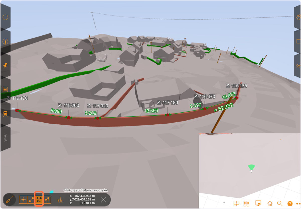
Multi-Point Measure: Tackles the challenge of measuring complex, non-linear distances across multiple points, facilitating detailed and accurate measurement paths.
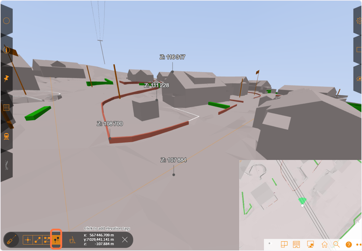
Elevation Tags: Addresses the need for identifying and visualizing the vertical positioning of elements within a project, crucial for accurate elevation assessments.
Toggle snap function: The function enables you to toggle snapping on/off for your measurements, useful when you e.g. want to snap to specific locations on a surface model.
1. Aligned Measure
-
Click on measurement tool
-
Choose two point measure
-
Toggle aligned measure
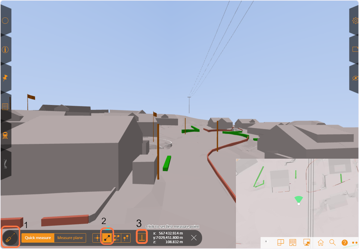
2. Aligned measure ON
When the "Normal to" or "aligned measure" toggle is turned ON, you measure the closest distance between selected entities, such as the closest distance between an edge and a surface, while ensuring that the measurements are aligned or perpendicular. When OFF you measure from point to point.
3. Multi point measure
This feature enables users to measure the distance between multiple points, get elevation and the total length in a model, all in one go. Whether it's assessing the length of a custom-shaped objects, or calculating the distance between various elements, Multi-Point Measure ensures precision and efficiency, making your modeling process smoother and more accurate.
4. Elevation tag
This feature shows the elevation of the any point or surface you select.
5. Toggle snap function
The feature allows you to turn snapping on/off when you do your measurements.
You can even turn snapping on/off while you are setting out your chain-measurement: